

The project
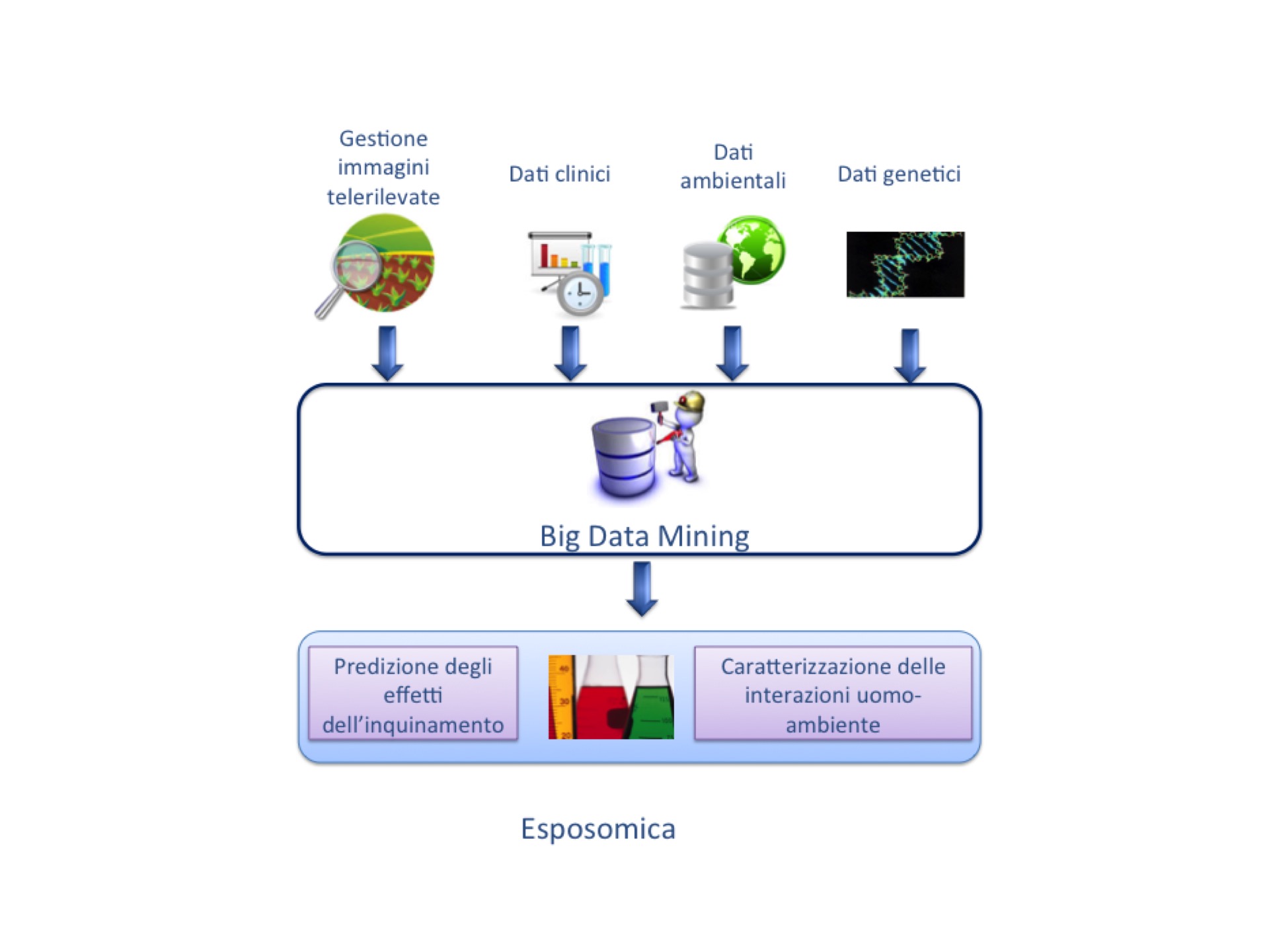
Exposomics is the study of environmental exposures, which affect people throughout their lives and their impact on the human organism.
Our project aims at estimate the correlations among environmental metrics obtained by analyzing satellite images (acquired since 1986 by American and European Space Agencies), air and water qualities evaluated by ground probes and occurrence of specific pathologies on people or patients affected by specific diseases (such as diabetes or hypertension) according to the detailed collection of the clinical records supplied by healthcare databases, as those provided by Pavia local health agency and treatment clinics.
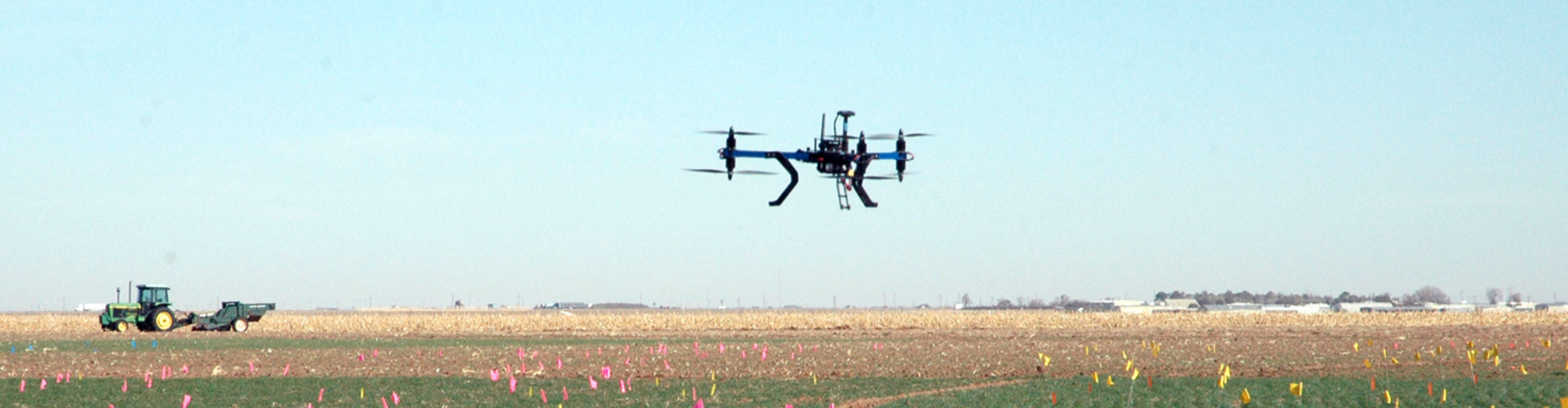
Thus, it is necessary to use innovative techniques to reliably analyze the available data (especially the remotely sensed ones) and integrate heterogeneous information collected over several temporal and spatial scale, as satellite images, data acquired by unmanned aerial vehicles (UAVs) equipped with multispectral sensors, and health records of specific patients’ sets.
Our proposal aims at developing one of the most advanced framework to efficiently manage the huge amount of data from the databases of the local/national healthcare agencies in order to link them to environmental metrics achieved by satellite imagery, taking advantage of the integration of multi-temporal records able to give a full investigation of the causes of considered diseases.
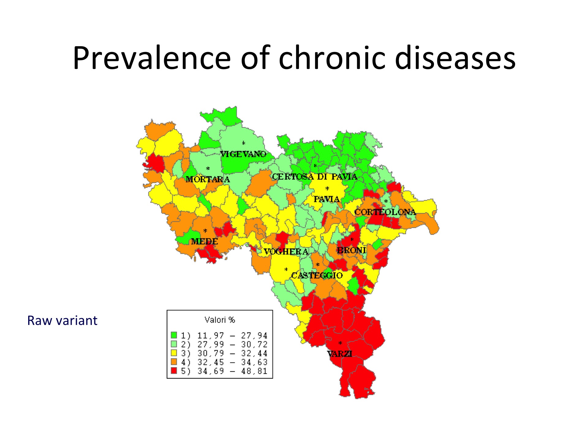
In this first stage of the project, we propose to acquire a UAV equipped with advanced sensors, in order to collect new environmental data to be integrated with the already available records. Hence, the result of this first stage will be the detailed environment-health map of the Pavia region.
This project will represent the first step towards the creation of a wider framework that will take the Pavia region as a test site, in order to thoroughly investigate exposomics by involving biomedical researchers as well, so that inferences and correlations that will be extracted on data analysis could be translated in scientific discoveries.
LINK
http://exposomealliance.org/
http://www.exposomicsproject.eu/
http://www.nature.com/news/daily-dose-of-toxics-to-be-tracked-1.11901
http://nas-sites.org/emergingscience/files/2011/05/03-exposome-newsletter-508.pdf
http://www.scienzainrete.it/contenuto/articolo/arriva-rivoluzione-dellesposomica
http://www.projecthelix.eu/
Video
Media Gallery


Rewards
- For all donors over a threshold 10 000 euros: the chance to select a test site to be thoroughly investigated.
- All donors will have the right to participate to an online poll for the selection of an area to be investigated using the UAV.
- Possibility to sponsor the project supporting the acquisition of the UAV or of the equipment.
Team
Riccardo Bellazzi
Full Professor | FounderRiccardo Bellazzi
Full Professor | FounderProfile
Paolo Gamba
Associate ProfessorPaolo Gamba
Associate ProfessorVittorio Casella
ProfessorVittorio Casella
ProfessorProfile
Luigi Manzo
ProfessorLuigi Manzo
ProfessorCarlo Cerra
Carlo Cerra
Backers
-
Altauto Srl CR7
-
Terre d'acqua CR7
-
Confindustria Pavia